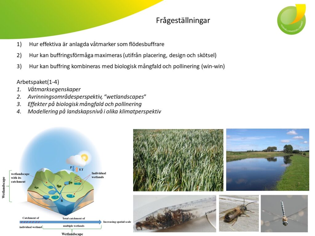
Activities
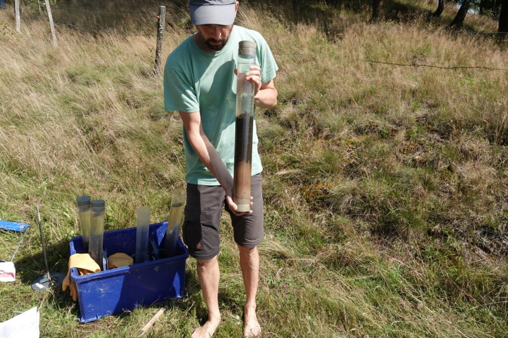
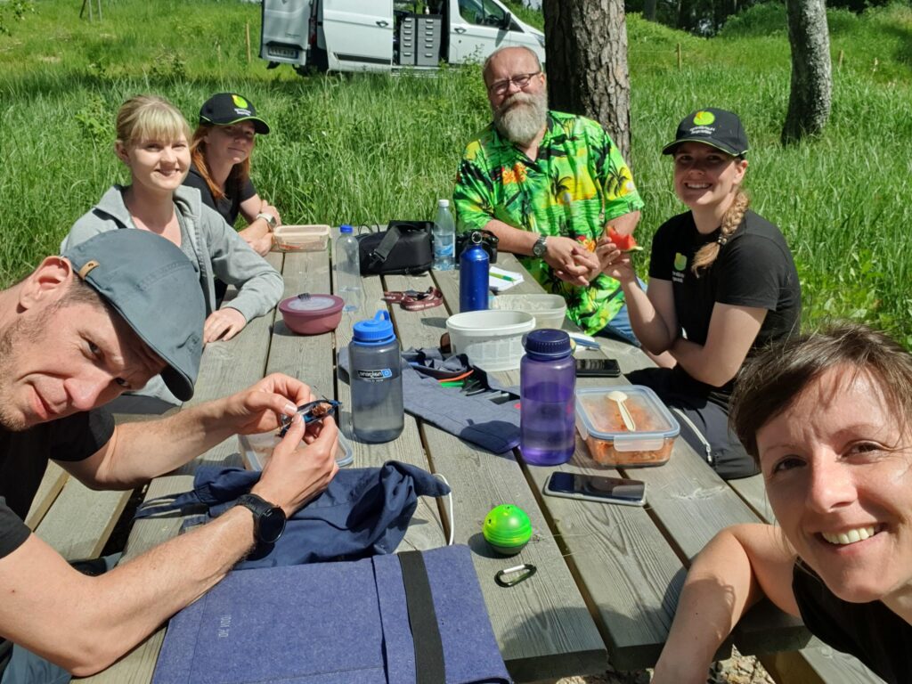
Project WetKit visit Halland
This week Pia and Joachim from project WetKit have been in Halland for fieldwork in ”our” wetlands. Colaboration is always rewarding and we hade good discussions on methods and the state of the wetlands. Pia and Joachim sampled sediment cores in 19 of the wetlands.
Field experiments with pollinators finished – emptying of wetlands postponed to next year
The field material (various traps nests and nest boxes) from the pollinator field experiments that now have been terminated, have been collected and stored. Due to the very high rainfall in August we could not carry out the planned test with effects of draining some of the wetlands. We have however got permission from the landowners so we will do it next year (weather permitting). This experiment (emptying of ca 14 wetlands) is part of all 3 projects (Wetlands as buffers, Management of wetlands and Wetlands 2.0) and will hopefully give answers to different research quesitons in the three projects.
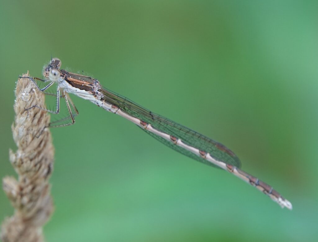
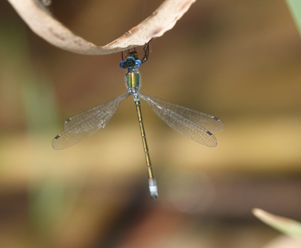
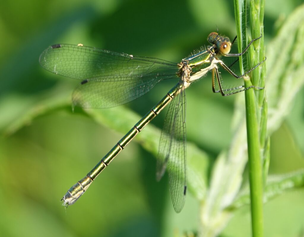
Interesting observation of dragonfly species in a Buffer-wetland
During our dragonfly surveys we found a Common winter damselfly (Sympecma fusca) at the wetland TA25. It is not rare in Sweden but have an easterly distribution and before our observation it had only been reorded once in Halland (in 2012) .
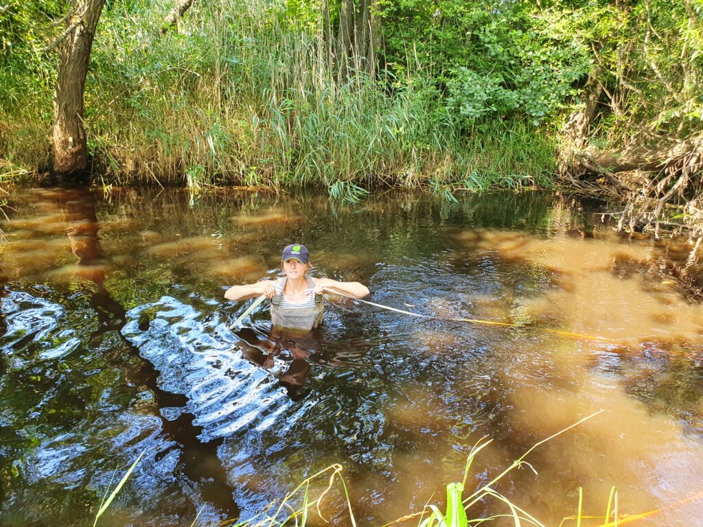
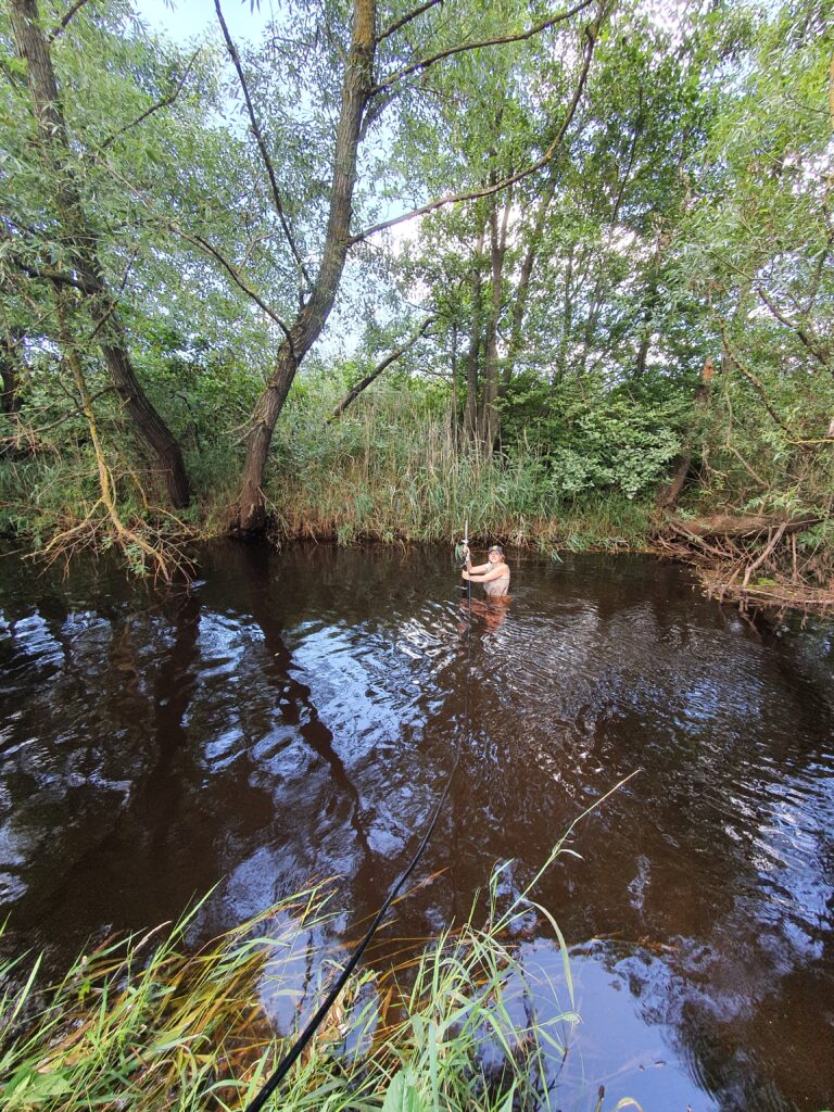
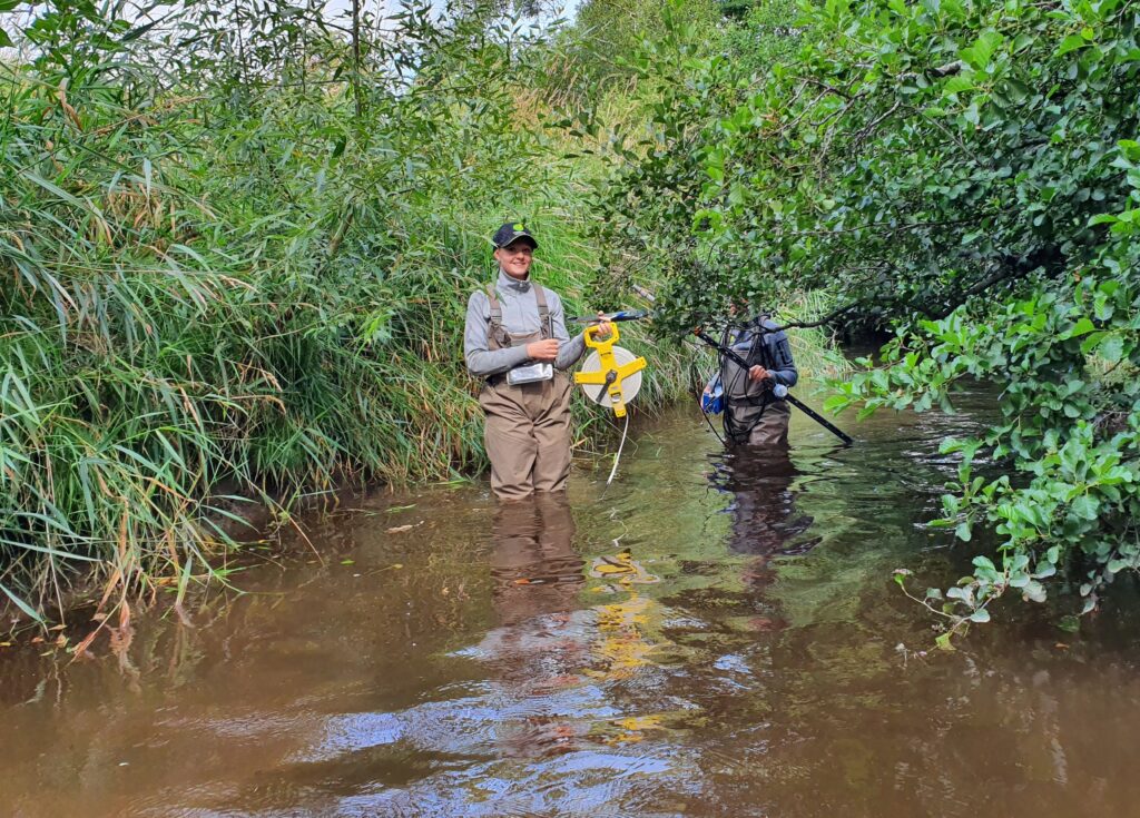
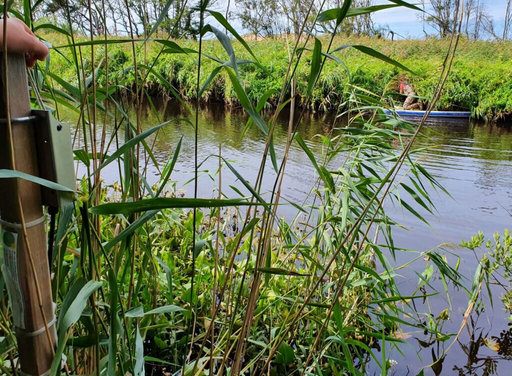
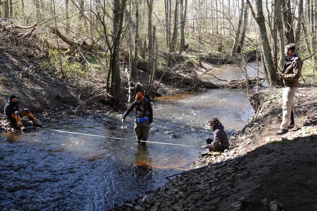
First flow measurments are done
We have now done the first flow measurements in the 11 streams at the same segments where we have the flowmeters located. These first measurements were done at low flow situations (low water levels), and we will repeat this under medium and high flows also, to get good data on the flow at different water levels. Then we get data on flow with 1 hours resolution by combining the flow measure data with the water level data. The photos show some of the field work in the different streams.
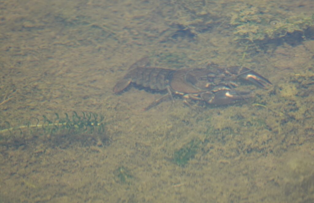
We expand our surveys to include selected invasive species
We have added a categroy to our field protocols. When we are surveying the 112 wetlands (batymetry, dragonflies, invertebrates etc) we now also check for selected invasive species. We have selected ca 10 species that are easily recognized and invasive, in order to get data on the occurrence of invasive species in constrcted wetlands in the agricultural landscape. It was not planned in the proposal, but our field surveys give us a good opertunity to get useful data on a large set of constructed wetlands as a side-effect. The species we check for are e.g. Nuttalls Pondweed + Canadian pondweed (Elodea canadensis + C. nutallii), Signal crayfish (Pacifastacus leniusculus), Red water lily (Nymphae alba, var. rocea) , Grass karp (Ctenopharyngodon idella), Yellow scunk cabbage (Lysichiton americanus), Himalyan balsam (Impatiens glandulifera), Japanese knotweed (Reynoutria japonica/Fallopia japonica), Giant hogweed (Heracleum mantegazzianum). The photo show signal crayfish in the wetland D31.
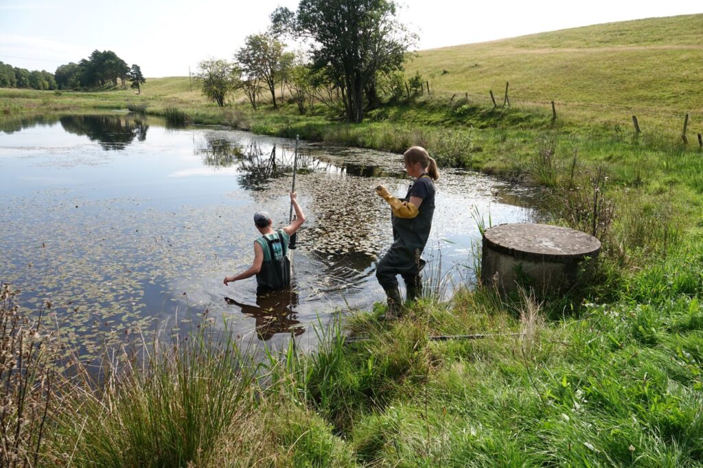
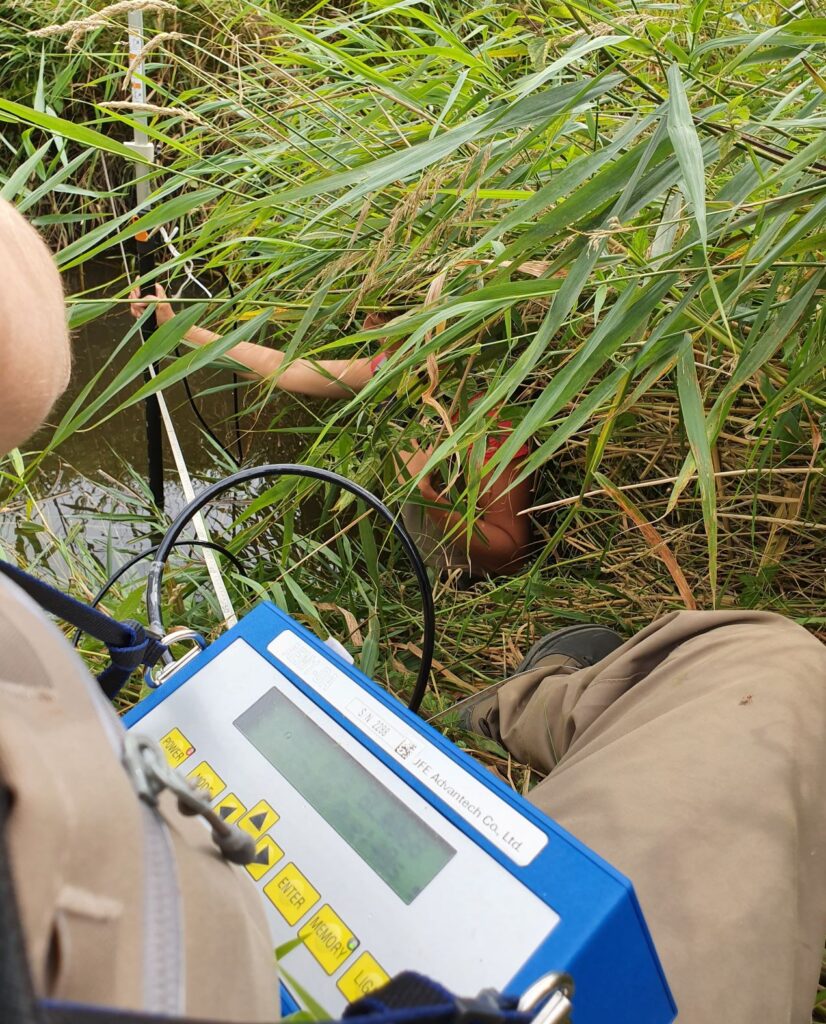
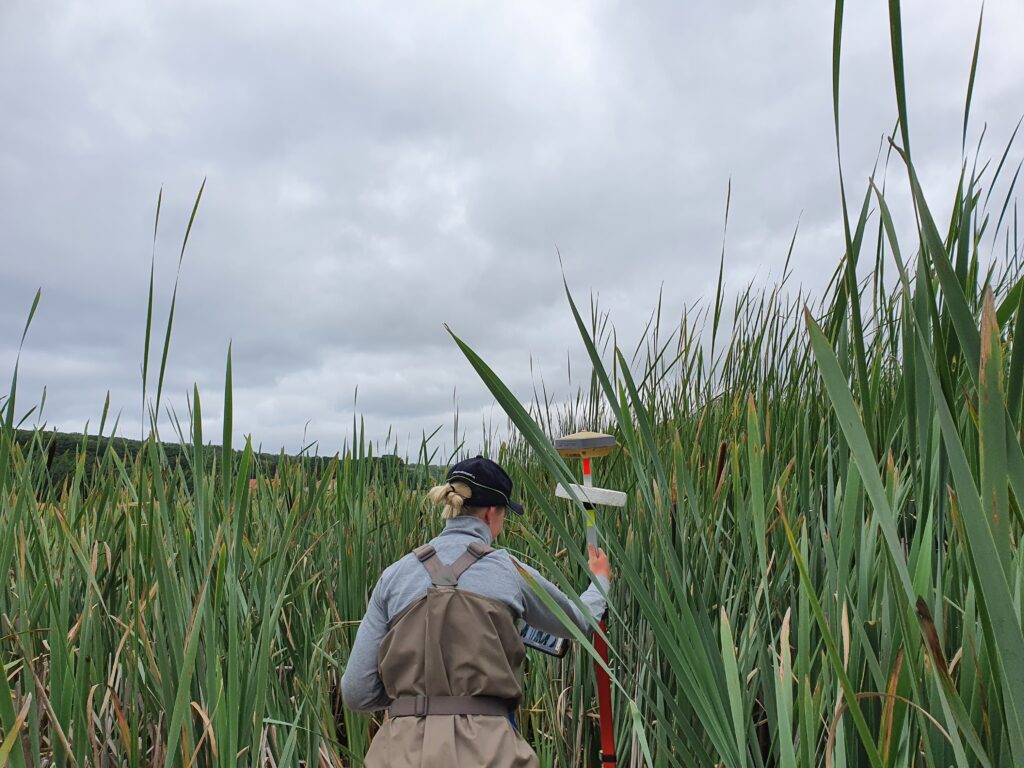
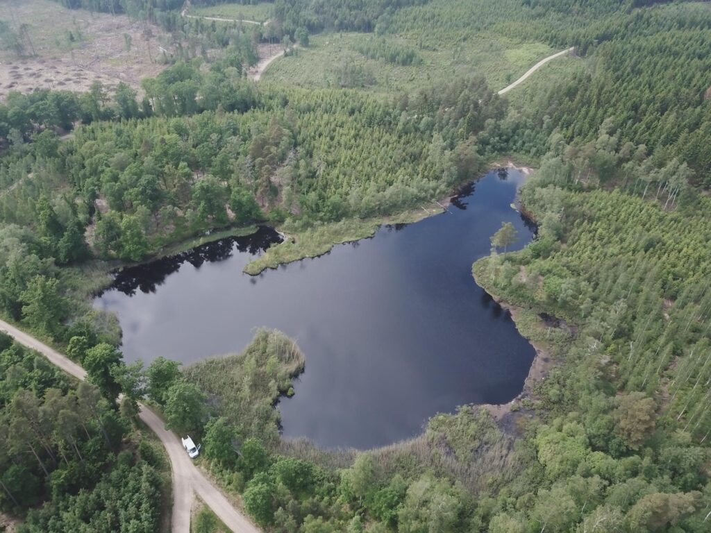
Bathymetry surveys continue
We continue with the time consuming work of depth profiling all the 112 wetlands. The wetlands vary quite a lot in terms of vegetation cover and water depth. The photo shows one of the more overgrown wetlands (KA5). In this wetland was also found Robust spreadwing (L. dryas) during the dragonfly survey.
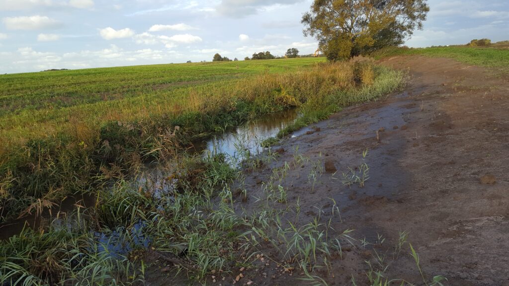
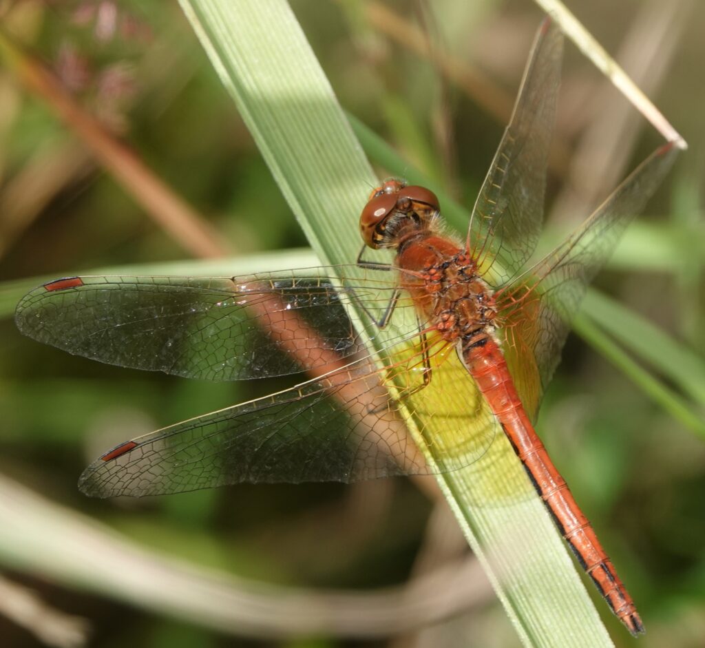
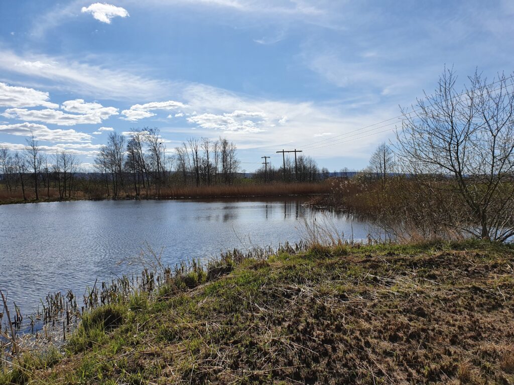
Some wetlands are dry at the moment – important habitat for adapted species
The dry weather has turned some wetlands into dry land. Theese extreme water level fluctuations are interesting for us to follow. Some species are adapted to theese habitats (shallow systems with occasional dryouts) and one example is the dragonfly Robust Spreadwing (Lestes dryas). The photos show the wetland ”D10” in the dry state and some specimen of Robust spreadwing found during our dragonfly survey in that wetland. This species is relatively rare in Halland and it is likely that constructed wetlands that dryout during summer is of major importance for the species. At our survey we found a quite large population of L. dryas at the site. Another species found at D10, with similar habitat requirements, was yellow-winged darter (Sympetrum flaveolum). It is also a rare species (likely to be included in the next update of the Redlist). For theese habitats, the management is especially important as they are sensitive for overgrowing with reeds and trees. D10 is grazed and mowed.
Invertebrate sampling continues this year
Peter has spent some 10 days in July in Halland to repeat the invertebrate sampling in the 50 selected wetlands that were investigated also last year. Focus was on Maialsie-traps. The photo shows the trap at the wetland ”TA25”
Cyanobloom study starts
Today Pablo Urrutia Cordero started his field sampling in 80 of our buffer wetlands to investigate occurence of Cyano algae and cyano toxins. We are networking together with Pablo to get synergistic effects from combining our projets.
Drone photography has started
We have started with the drone to test how efficient it is to get reliable data on emergent vegetation cover. The actual pgotography will be done in late summer when vegetation is at its peak, but we tested the drone today.
Our activities in the Buffer project has been filmed
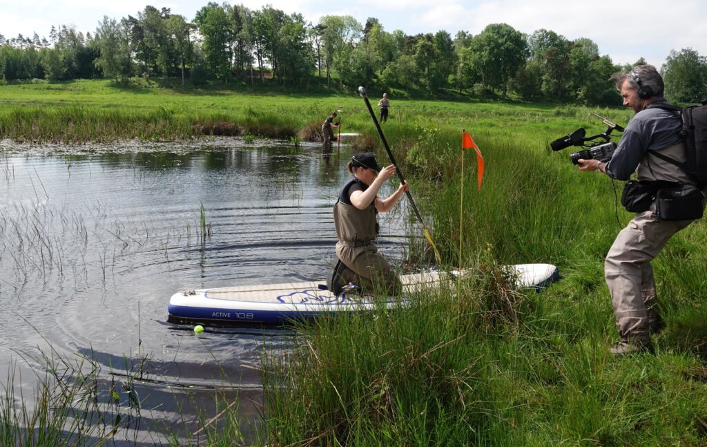
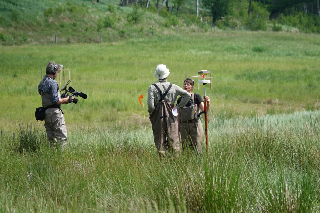
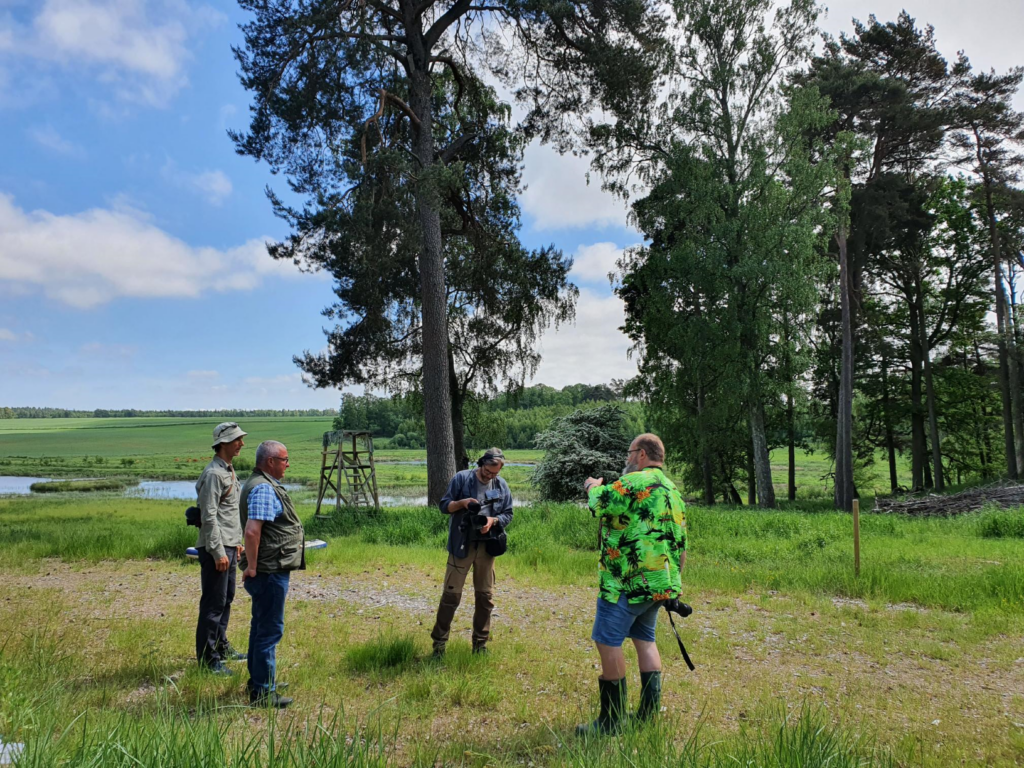
A professional film company (Heurgren Film AB) have spent two days following our work. In a project we network togwether with (WetKit) one part was to produce a film about constructed wetlands, and since we have several ongoing activities the film crew spent two days in Halland filming and interviewing us when we did our field work and discussed with the landowner.
3rd newsletter sent to landowners
Today we sent out the 3rd newsletter to the ca 8o landowenrs in the project with information about this years planned studies in their wetlands. Since we will take photos of all wetlands with a drone we also offered to send the pictures to the landowners if they wanted, which was quite popular.
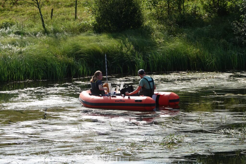
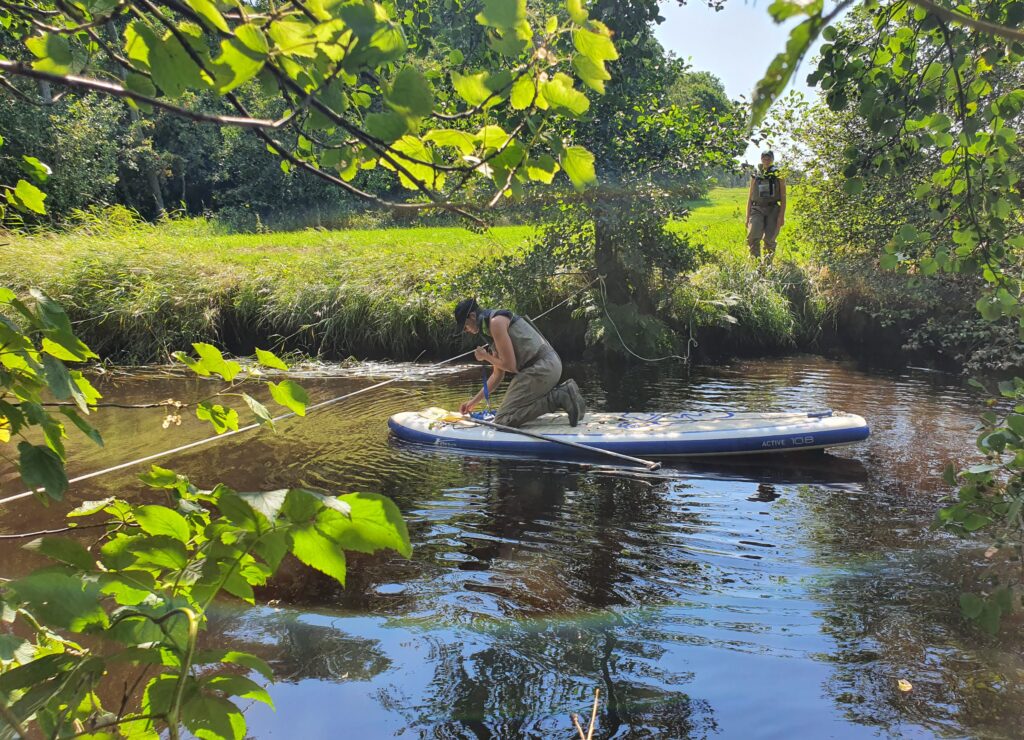
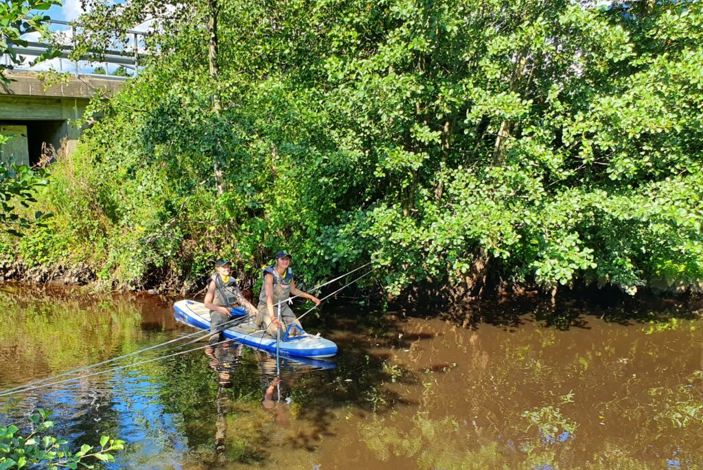
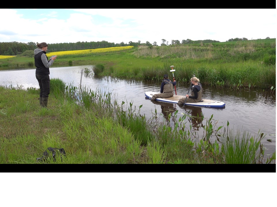
Bathymetry measurements are ongoing
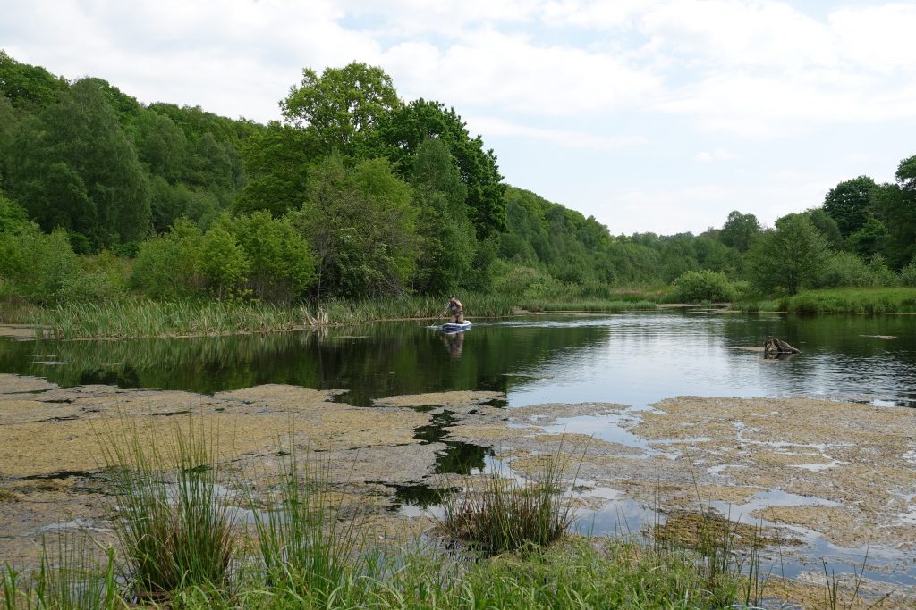
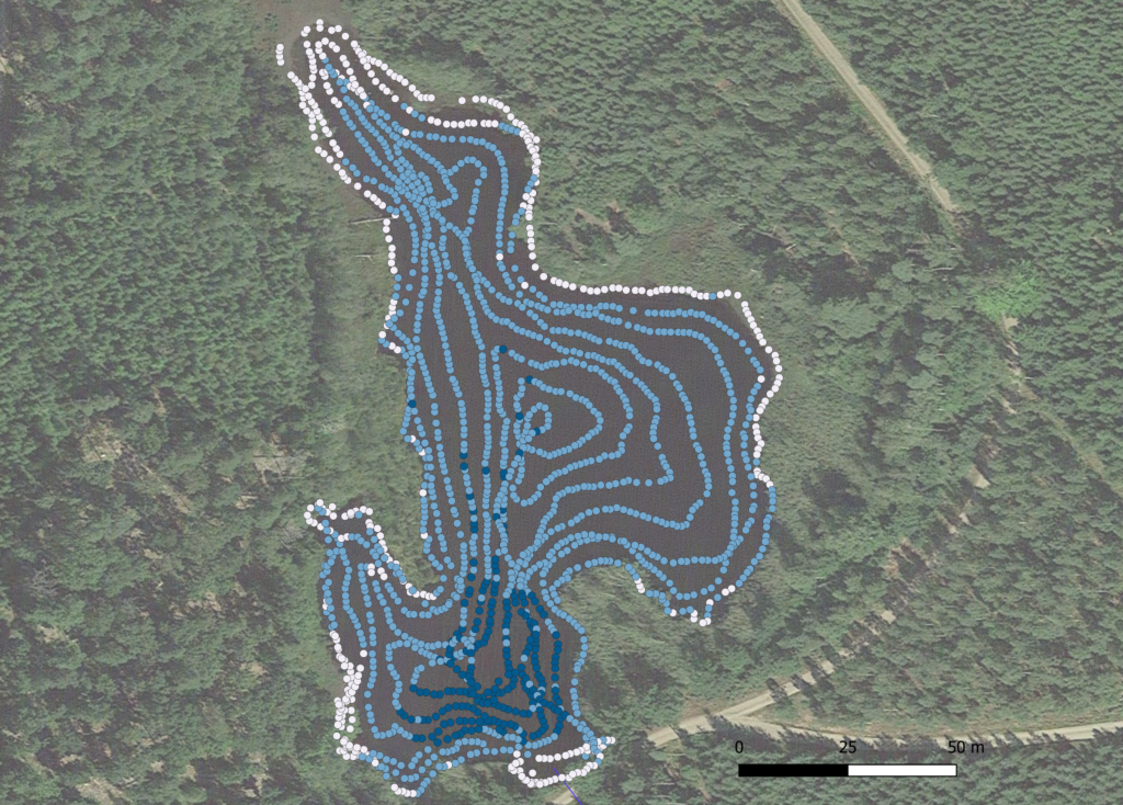
By combining sonar data that we get from paddling with a SUP and sonar in the open water, with high resolution GPS-measurements from the shoreline and in high and dense vegetation in shallow water we get very good data on the depth and shape och the wetlands. The photos shows Sofia paddling with a sonar (left) and the photo to the right shows the position of the water depth data points from the sonar (blue) and the water depth data points from the GPS (white) From this we can construct very detailed depths curves of the wetlands.
Bathymetry measuremnts ongoing
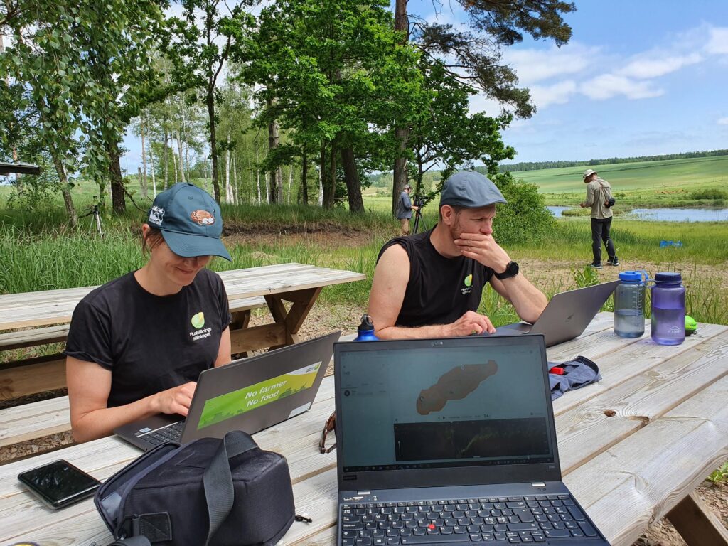
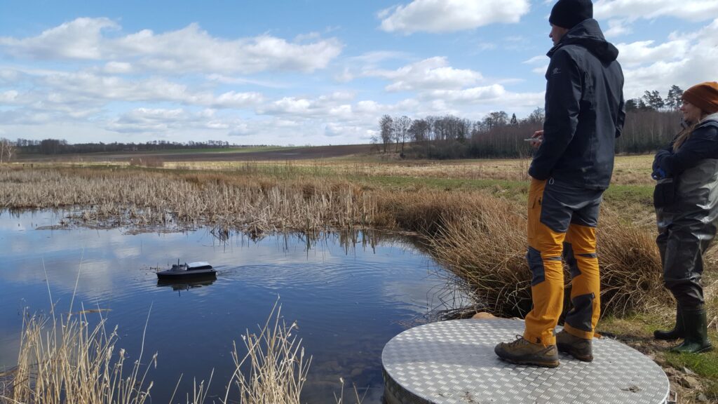
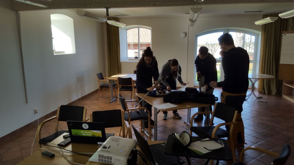
Testing bathymetry methods and flow measurement strategy
This week we had a 2-day meeting with Jerker Jarsjö and Imenne Åhlén (Stockholm University), to decide methods to produce bathymetric maps of the 110 wetlands and to finalise our strategy for flow measurements in the 11 streams in our joint project. It was a very productive meeting and the photos show equipment testing and part of the field work including trial with a remote-controlled boat with a sonar to map the wetland topography (bathymetry).
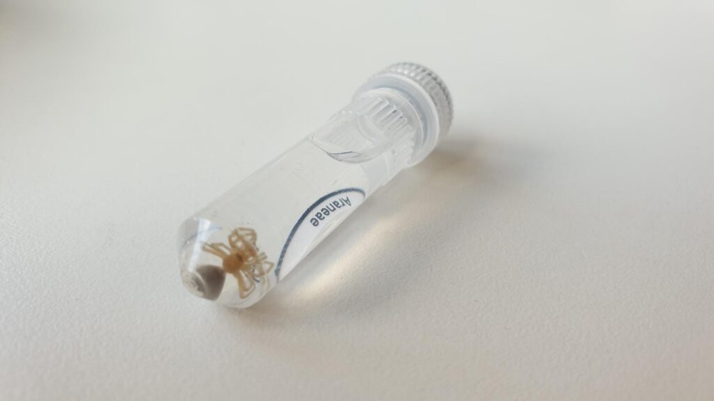
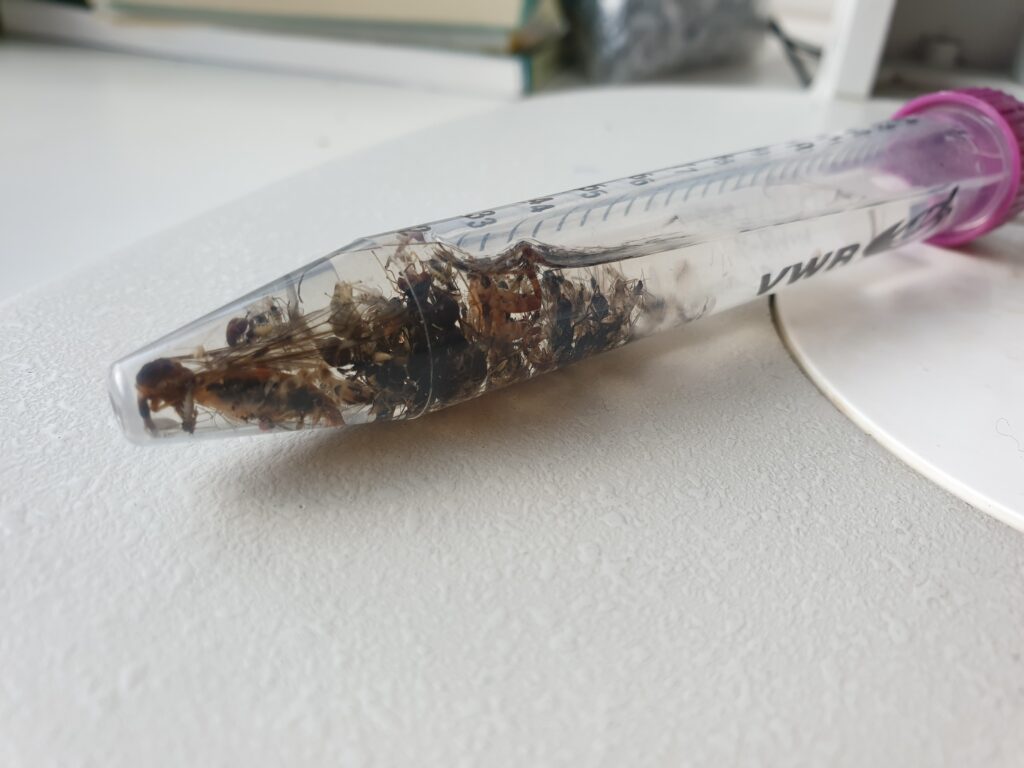
Sorting and identifying organisms continue…
The sorting work is progressing within the project with additional groups fully identified . The very large spider material is now identifed by Raul Vicente, and the dance flies (Empididae) by Sven Hellqvist. Examples from the two organism groups are shown below. Planning for this year’s studies is also in full swing. As we have received funding for nutrient analyzes in Uppland from Bolincentret’s RA3 and RA7, as well as the Albert and Maria Bergström Foundation, we will be able to collect very interesting data to investigate the impact of nutrients on spider and insect communities. We have also received funding for a drought experiment in Halland from Bolincentret’s RA8, and it will be very interesting to see how drought affects spiders’ condition and food preferences.
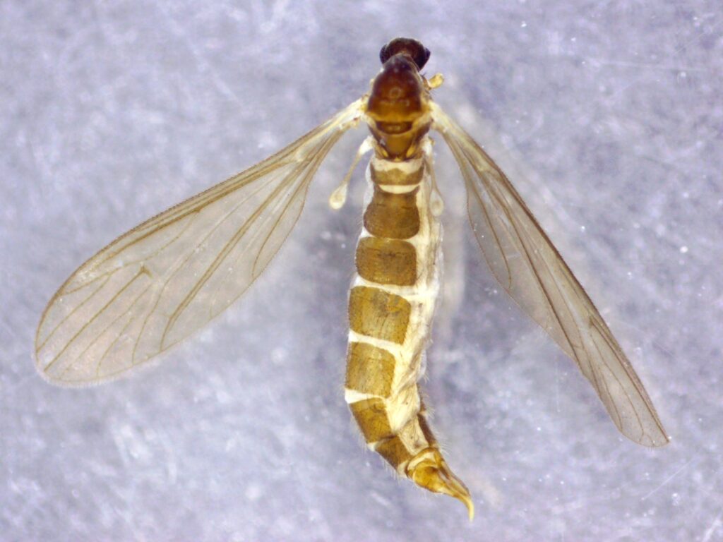
All the Crane flies (Tipuloidea) are now identified and counted
Another group of insects from the Malaise traps survey in 2020 has now been identified. it is the Crane flies, where we found a total of 47 species in Halland and 39 species in Uppland. Of these, 7 were new species for Halland and 4 new species for Uppland. The most exciting species was Paradelphomyia nigrina, which is a northern species and has only been found a few times in Finland and once each in Sweden (Dalarna) and Norway. The species was found in our traps in Uppland, and identified by Michael Andersson, Sweden’s leading expert on Crane flies. He has also taken the photo below
Tuvklotspindel (Rugathodes instabilis) – new species for Halland
The collection of invertebrates last summer continues to reveal interesting findings as the experts go through the material. The latest interesting discovery regarding species biogeographical data was the spider Rugathodes instabilis that was found in one of our wetlands in Halland (see photo below). It has only been found with a handfull individuals at 4 sites in the counties of Uppland, Östergötland and Skåne before, and now also Halland! For more info: https://artfakta.se/artbestamning/taxon/rugathodes%20instabilis-101722
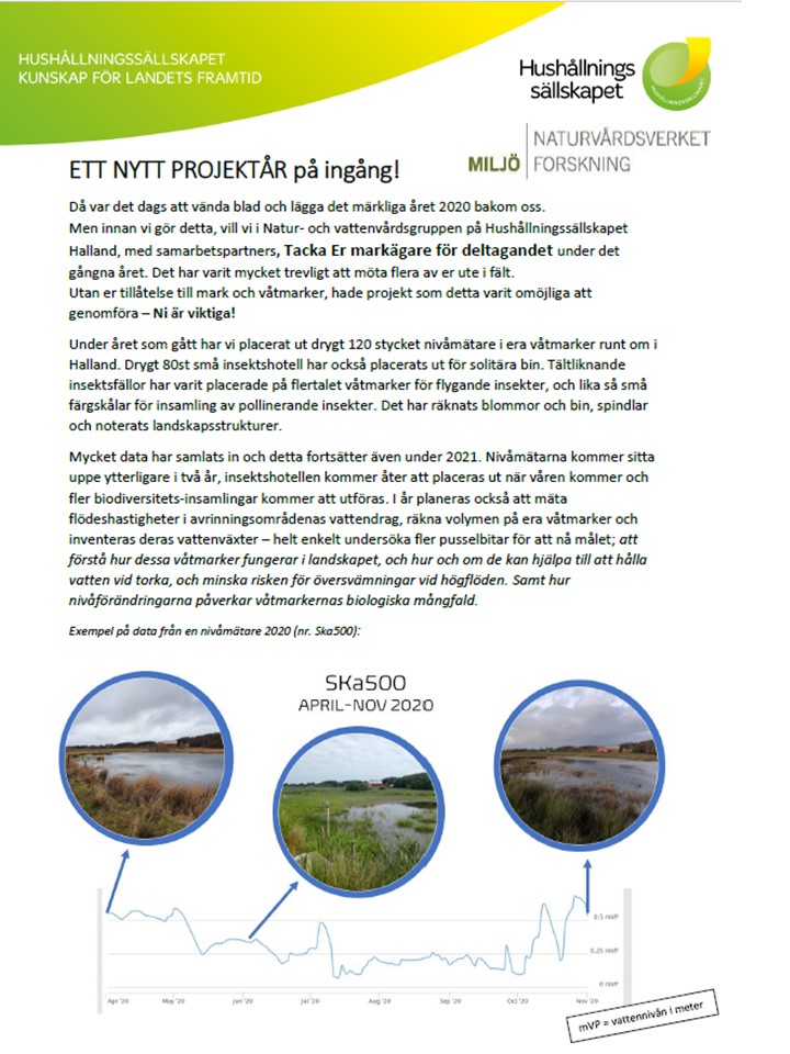
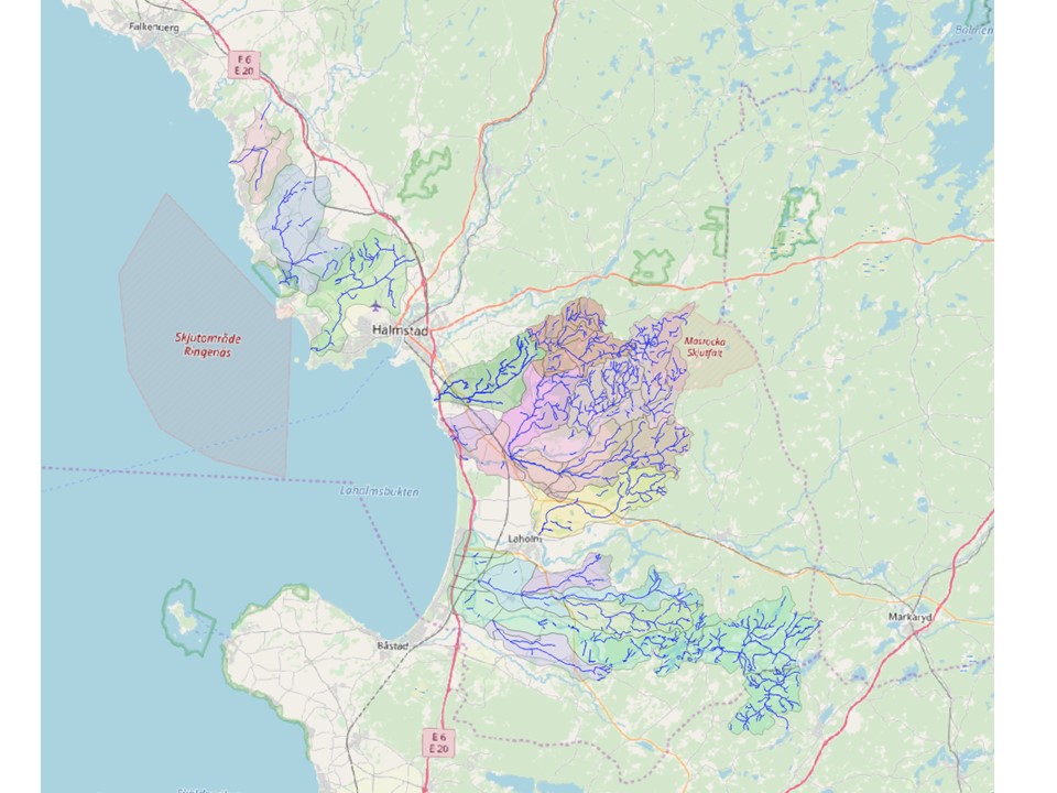
Annual meeting 22/3 2021(Naturvårdsverket)
Naturvårdsverket (Swedish EPA) arrangerad an annual meeting for the 8 projects awarded in the call. We got presentations on the progress in the varius projects and also information from the SEPA, Formas and SGU. The image beloww shows a map of the location of all the water level meters from our project presentation. The presentation can be found here

Status report submitted
The status report for our project is now submitted to Naturvårdsverket
New species for Sweden in our sampling!
The first results from last years sampling of invertebrates have now been delivered by the experts that have spent the winter sorting, counting and identifying the specimens. One group that has been done so far is the family of dancing flies (Empididae). Among the specimens was a species never encountered in Sweden before! It is the fly Hilara manicata. Apart from this new species for Sweden, also 3 new species for the County (Halland) were found. Several organsim groups remain to be counted and identified, e.g. spiders and beetles and it will be interesting to see if we get more surprises.
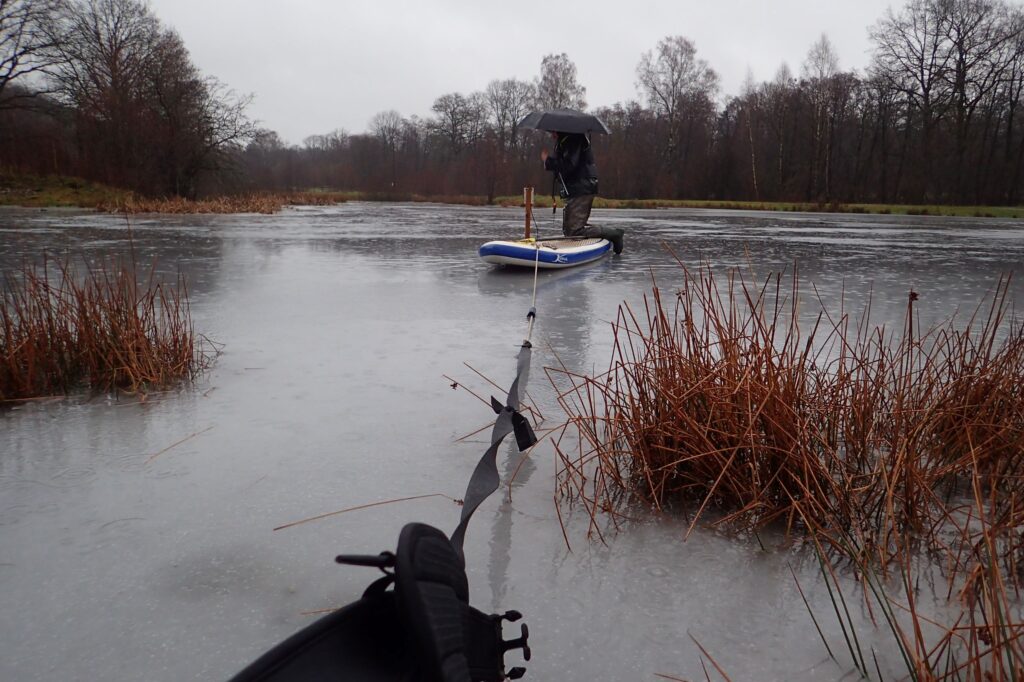
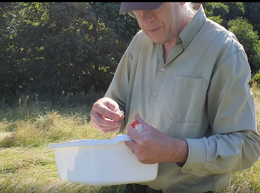
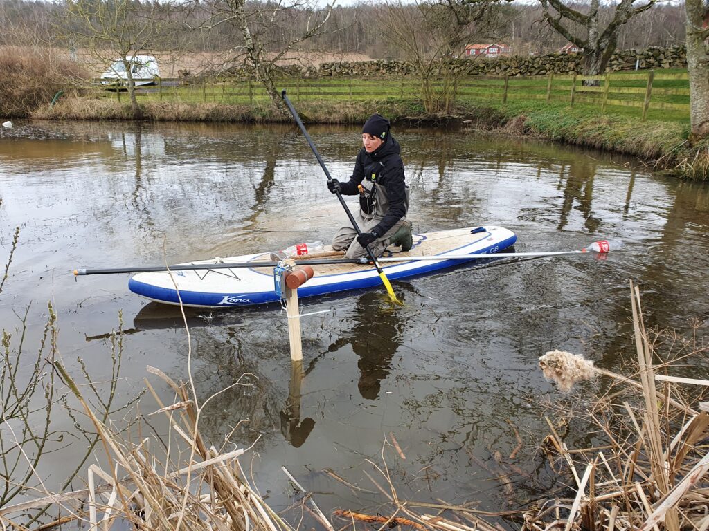
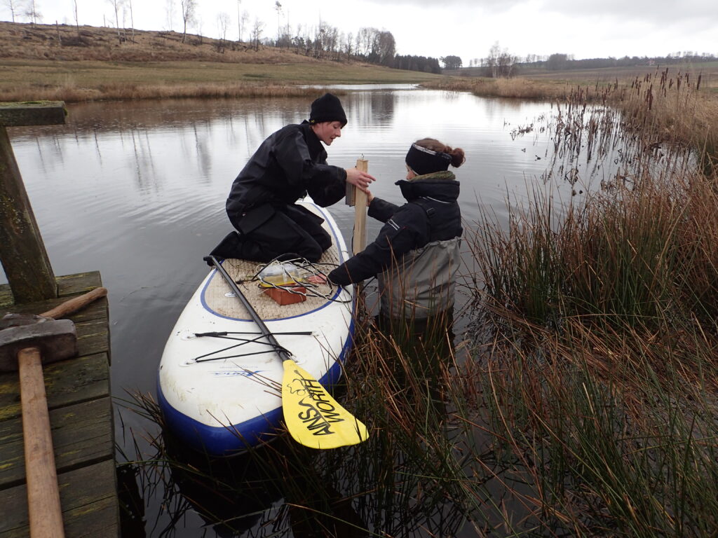
Maintenance of water level meters
We had to change batteries in two of the water level meters. It was a bit difficult due to a combination of ice and rain, but with a SUP and umbrella Lea and Sofia managed! Good work!
Second newsletter to landowners
Today we sent out the second newsletter to all the landowners (> 80).
First meeting with the WetKit project
Today we had a very good meeting with the researchers from the project WetKit (www.wetkit.weebly.com). We will cooperate regarding sampling sites and sampling strategies and will thus get more data from the sites leading to better understanding on e.g. multi-functionality of CWs. See also under the tab Networking
Third sampling
In August we did the third sampling campaign of invertebrates in 50 CWs, with Malaise-traps, colour pans, suction sampling, and pit fall traps. The picture shows insects collected by Malais-trap.
Second sampling
In July we did the second sampling campaign of invertebrates in 50 CWs, with Malaise-traps, colour pans, suction sampling, and pit fall traps. The picture shows collection of spiders after suction sampling at one of our project CWs.
Sampling campaign
In June we did the first sampling campaign of invertebrates in 50 CWs, with Malaise-traps, colour pans, suction sampling, and pit fall traps. The picture shows a malaise-trap and colour bowls.
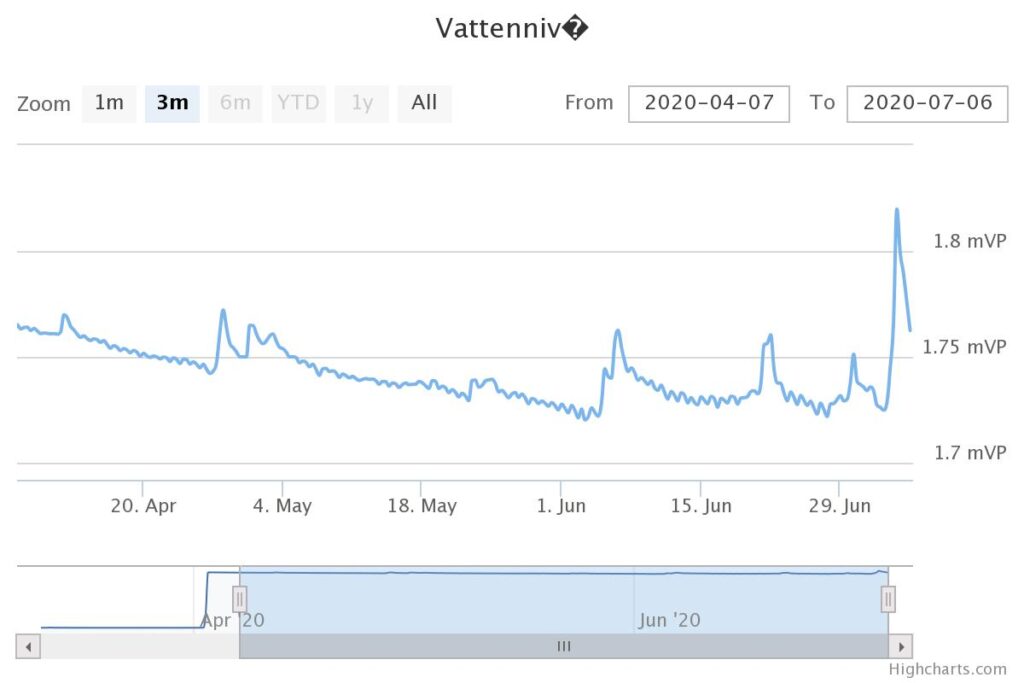
Data gathered
An example of the data gathered. The picture shows untreated data, illustrated as a graph directly generated by the program. It is good for a quick check on the water level meters from the office, without have to go out in the field, and means that we have good control of the water level situation in all the CWs at all times. All data points are downloaded separately.
12 level meters
Now our level meters are deployed in 111 wetlands and 12 level meters are located in streams and they all register the water level 1 every hour and transfer data to us automatically. (bild 9). That means that every day we get 3 000 in situ data points on water levels. In a year we will get a bit over 1 million data points. The water level meters are planned to be on sites for 2.5 years thus giving us 2.7 million data points on water level changes in CWs and stream.
Deploying water lever meters
Here is a film showing part of the process of deploying water level meters and nest traps in a CW .
Environmental research day
At the Swedish EPA´s “Environmantal research day” (Miljöforskningsdagen) there was a time slot for short presentations of the projects on wetland ecosystem services. So today the project leaders for the 8 projects again did short presentations of their projects, again online.
Kick-off
The kick-off meeting for the 8 awarded projects had to be done online due to Corona. It was interesting to hear about the other projects and valuable for future possible collaboration between projects and synergistic effects.
Deploying level meters
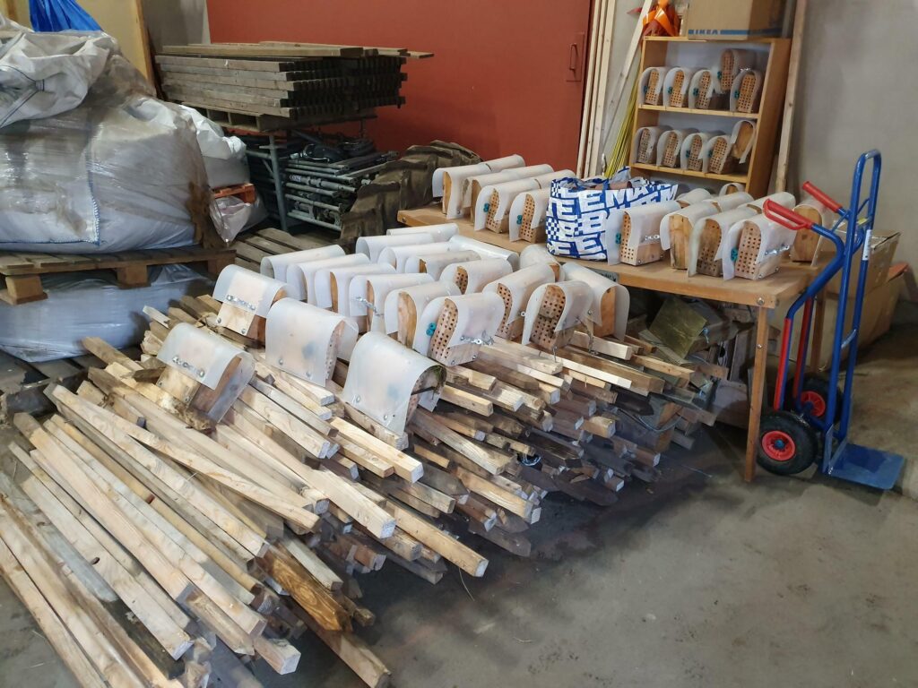
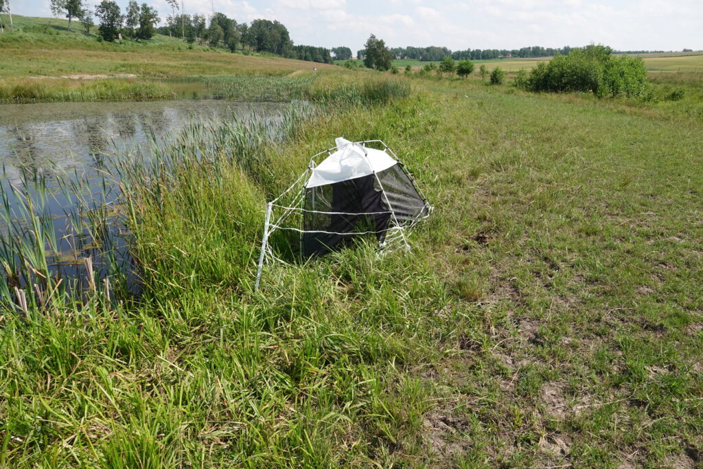
The work with deploying water level meters continues. It is time consuming, but our method works well, on the meters we also place trap nests to investigate the pollinator population at the sites. It is the brown-orange cylinder seen in the picture.
Meetings
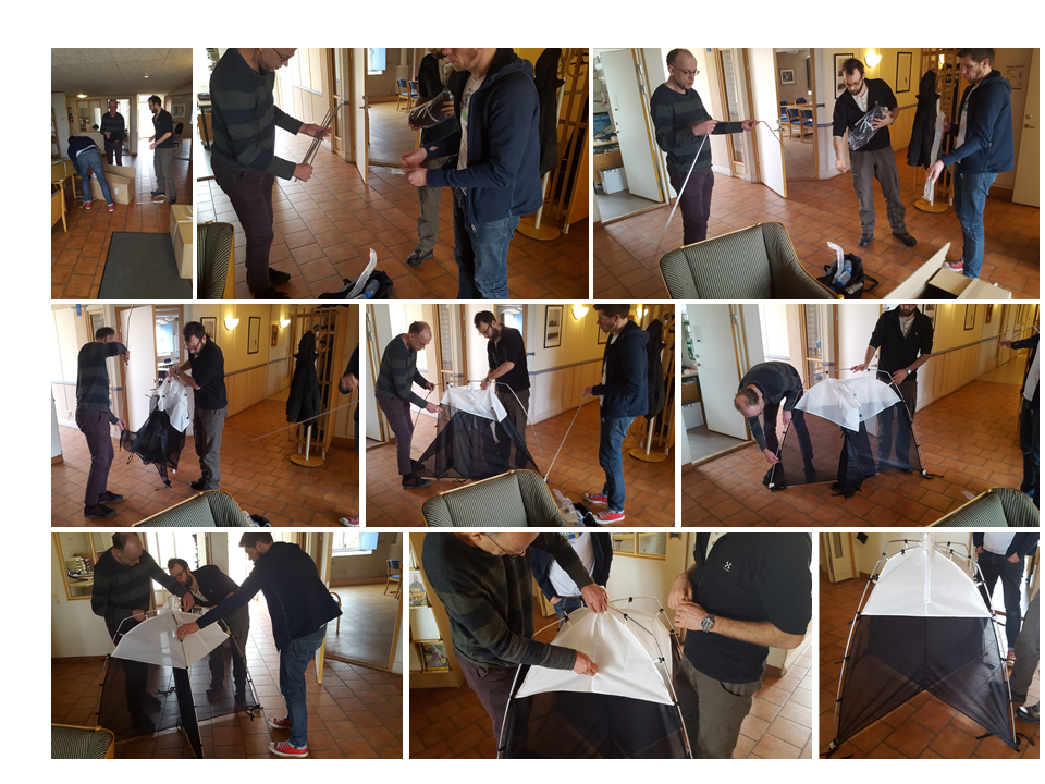
We had a meeting in Halland to plan for this season biodiversity studies. We also put together one of our SLAM-traps (Malaise traps). We have 25 of these, which will be used for sampling flying insects in the project.
Level meters
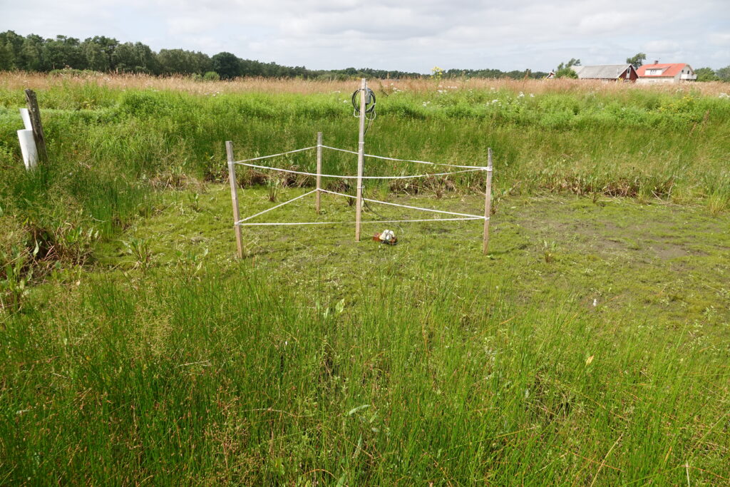
Now the first two water level meters are placed in the wetlands .
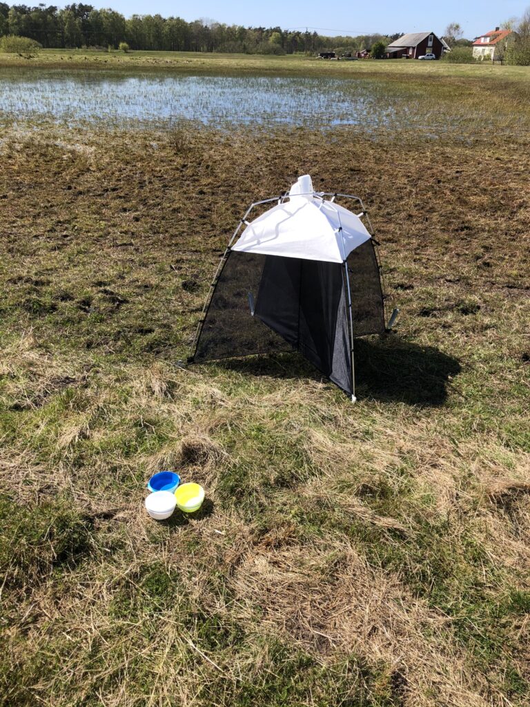
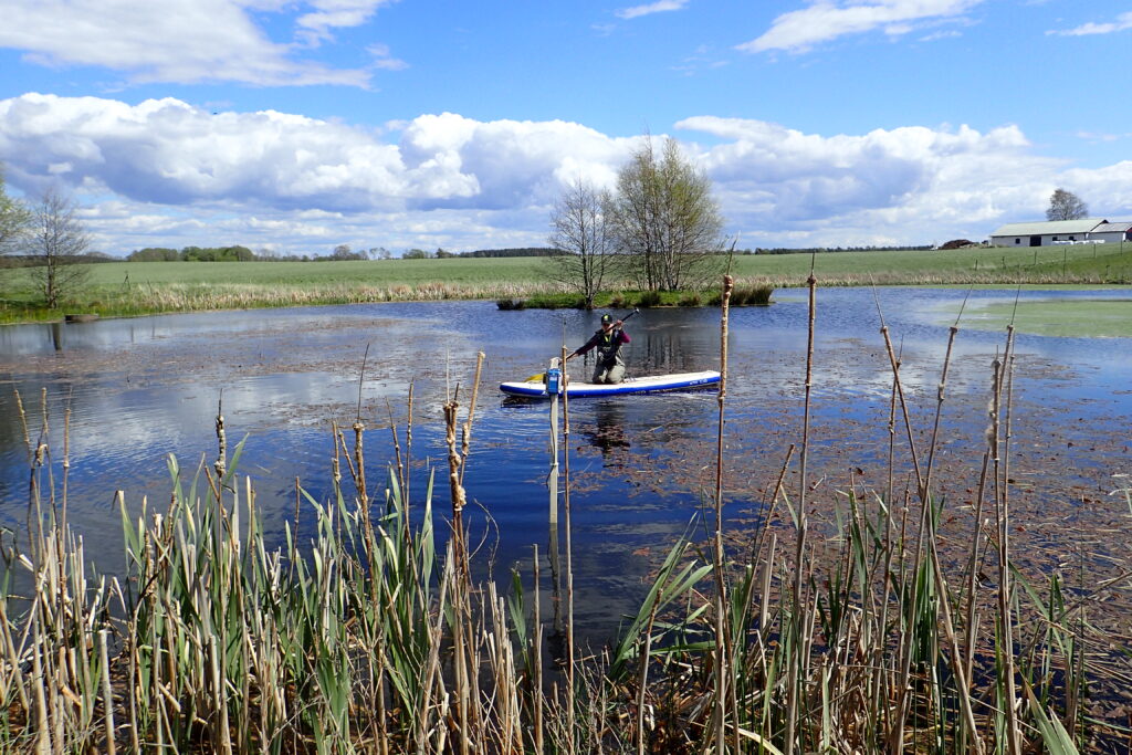
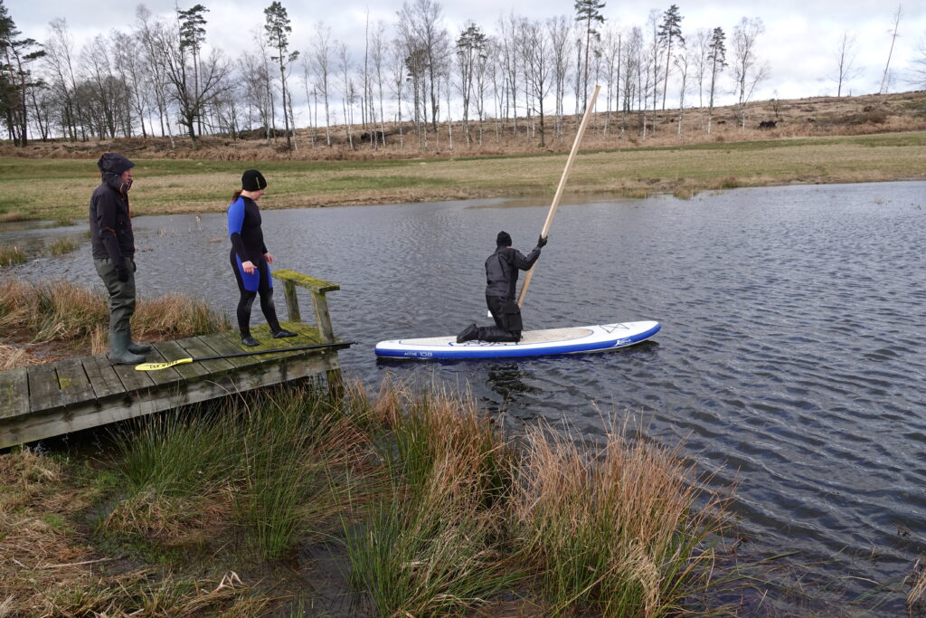
First field test
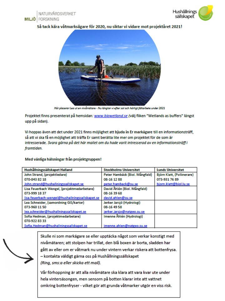
Today we did our first field test to find a time efficient method to deploy all our 120 water level meters in wetlands and streams. We found that a stand-up paddle board (SUP) is stable enough to work from and at the same time relatively easy to transport between wetlands and to carry along in the field. It is also manoeuvrable on the water, so it is possible to easily find the deepest spot in the wetland.
Project meeting
Since the project manager (John) had a meeting in Stockholm for another project we took the opportunity to have a meeting at Stockholm University, where John, Peter and Jerker discussed the selection of drainage areas and wetlands for “Wetlands as buffers”.
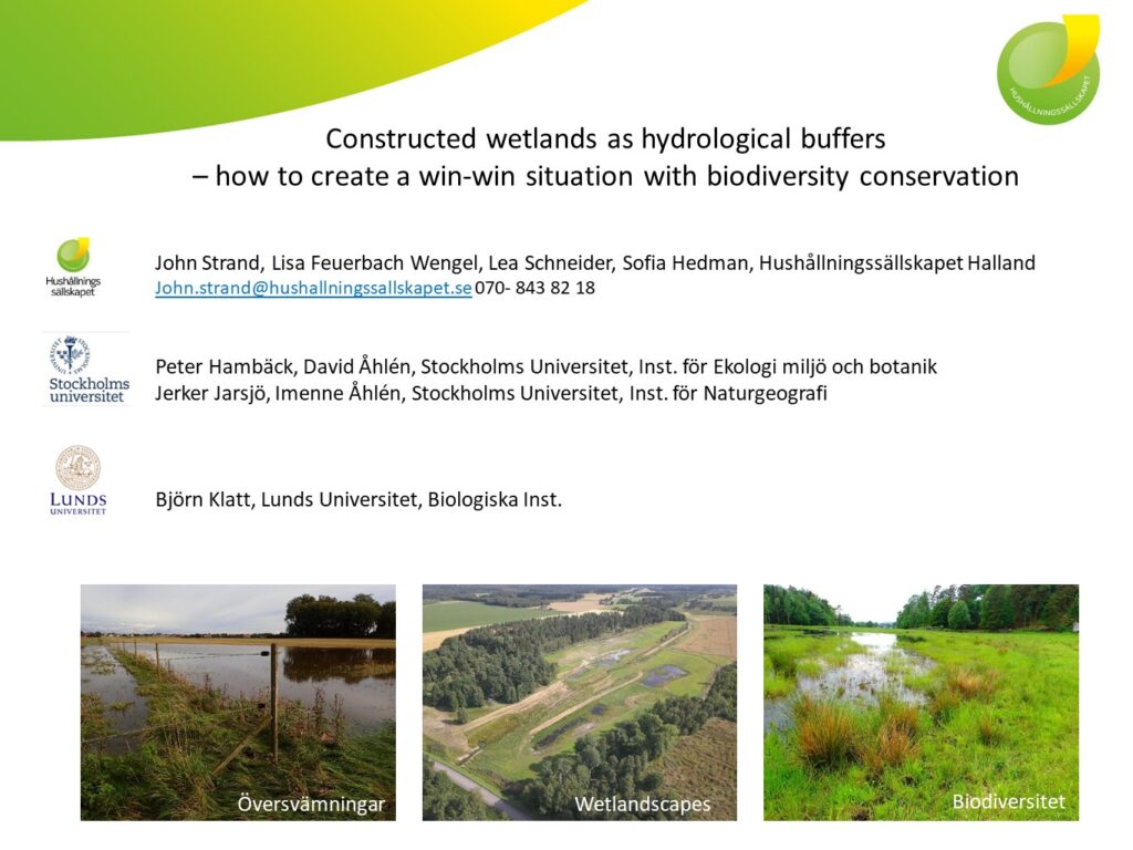
Project started
Today our project officially started! The full name is: “Constructed wetlands as hydrological buffers – how to create a win-win situation with biodiversity conservation” but we will mostly use the short form; “Wetlands as buffers”.

BioWetland is launched
Welcome to BioWetland!
Wetlandscapes & Biodiversity – Buffer, Biodiversity and Bees
Research on how constructed wetlands(CWs) function hydrologically in a river basin perspective and how hydrology and its interactions with wetland design, location and management affect the biodiversity in wetlands and at the landscape level, with focus on arthropods in terrestrial-aquatic boundaries and pollinators.